I am an urbanist by training and I work as a developer in data visualization, mapping, and web development.
I also teach classes and workshops on these topics.
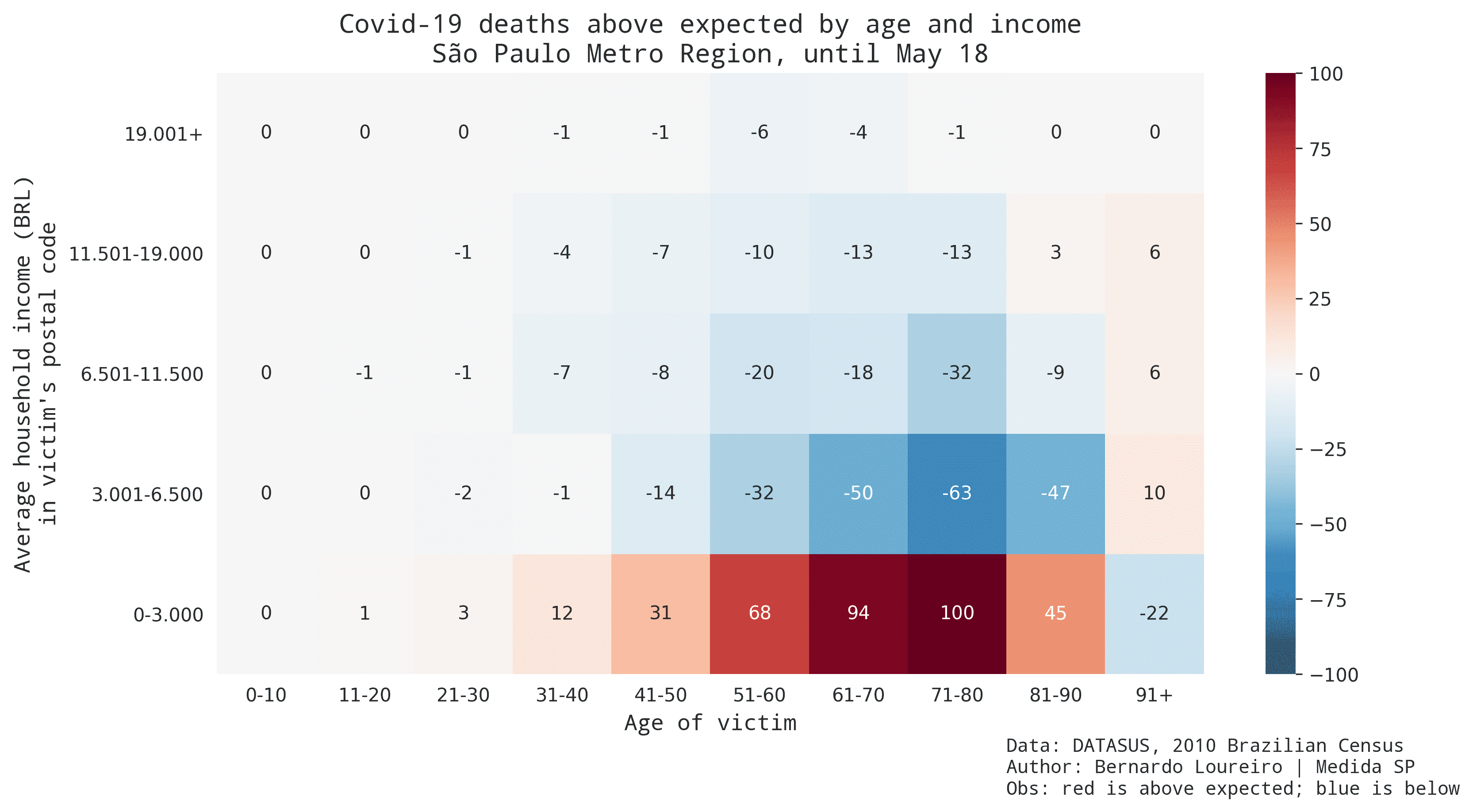
In the past I've created and ran Medida SP, a data visualization consultancy in São Paulo, Brazil.
Get in touch: LinkedIn